TM-04Red Sea · CENTCOM AOR
Part of the Scenario SimulatorStrategic Question
Can a 20-mile strait reroute Asia–Europe trade around Africa?
What To Notice
Houthi anti-ship missile and one-way drone fans extend across the lane. Coalition Task Forces operate from Djibouti; Saudi/Eritrea coastlines anchor the western shore.
N ↑
Scale · Indicative
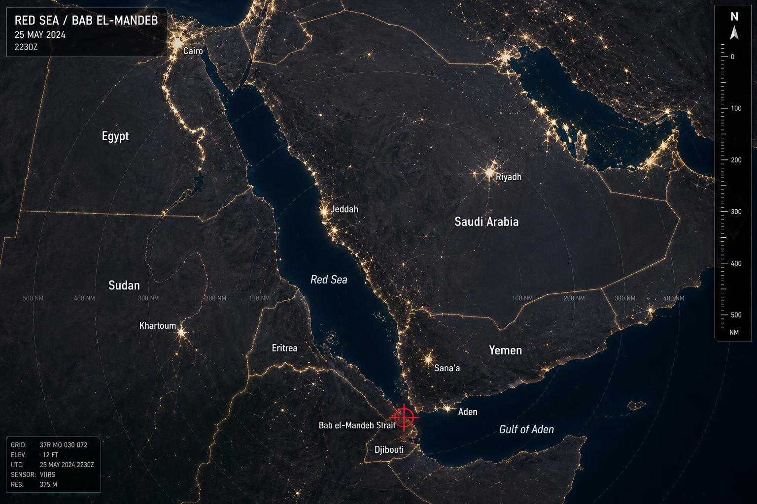
Red Sea / Bab el-Mandeb Theater Map
A 20-mile gate between the Red Sea and the Gulf of Aden. Whoever holds the Yemeni shore can tax — or shut — the Asia–Europe shipping artery and Gulf energy flowing to Europe.
Assessment MetadataACTIVE
- Analyst
- Warlord Desk · Strategic Analysis Division
- Published
- Mar 15, 2025
- Updated
- May 16, 2025
- Confidence
- HIGH
- Likelihood
- POSSIBLE
- Time horizon
- 90D
Open-source reporting, official statements, satellite imagery, shipping data, and market signals. No classified inputs.
Methodology →Analytical Chokepoints
- Strait width
- ~32 km (20 mi)
- Suez transit share
- ~12% of global trade
- Cape reroute cost
- +10–14 days
- Coalition basing
- Djibouti ~200 km
Active Scenarios
Market Spillover
Shipping & Insurance · Oil & Energy
Pressure Points
- ~12% of global trade through Suez–Bab el-Mandeb
- Cape of Good Hope reroute adds 10–14 days
- Houthi ASCM & one-way drone reach blankets the lane
- Coalition basing in Djibouti within 200km
Why the Geography Matters
The strait narrows to 20 miles between Yemen and Djibouti/Eritrea. Yemeni highlands give the Houthis line-of-sight and standoff range across the full lane; the western shore is friendlier to coalition operations.
Map Legend
- Pressure Points
- View Theater Map
- Escalation Risk
- Key Pressure Point