TM-06South Asia · INDOPACOM/CENTCOM seam
Part of the Scenario SimulatorStrategic Question
Can two nuclear powers manage escalation under domestic political pressure?
What To Notice
Kashmir is the political flashpoint; Punjab is the operational corridor. Indian conventional superiority pushes Pakistan toward early nuclear signaling.
N ↑
Scale · Indicative
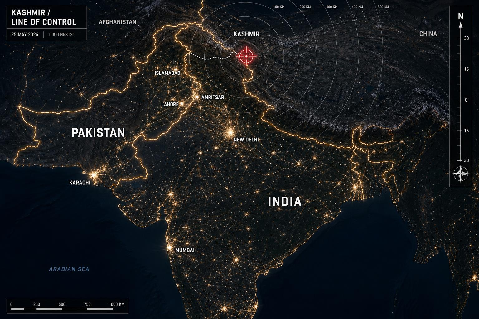
India–Pakistan Theater Map
A 3,300km frontier of nuclear neighbors with short warning times. Kashmir, the Line of Control, and the Punjab corridor compress every crisis into a window measured in hours, not days.
Assessment MetadataWATCH
- Analyst
- Warlord Desk · Strategic Analysis Division
- Published
- Mar 15, 2025
- Updated
- May 8, 2025
- Confidence
- MODERATE
- Likelihood
- POSSIBLE
- Time horizon
- 90D
Open-source reporting, official statements, satellite imagery, shipping data, and market signals. No classified inputs.
Methodology →Analytical Chokepoints
- Line of Control length
- ~740 km
- Warning time
- Minutes
- Indus Waters leverage
- Treaty-bound; political weapon
Market Spillover
Indian Equities · Gold · EM FX
Pressure Points
- Nuclear-armed neighbors with short warning times
- Indian conventional edge vs Pakistani first-use posture
- Indus Waters Treaty leverage
- Chinese pressure across the LAC during any crisis
Why the Geography Matters
Mountain warfare in Kashmir, armored corridors across Punjab, and a coastal Karachi flank. Both sides field nuclear delivery from multiple basings, compressing decision time for political leaders on either side.
Map Legend
- Pressure Points
- View Theater Map
- Escalation Risk
- Key Pressure Point