TM-01Persian Gulf · CENTCOM AOR
Part of the Scenario SimulatorStrategic Question
Can a single coastline gate the world's oil market — and for how long?
What To Notice
Iran owns the northern coastline and the high ground; the tanker lane hugs Omani waters. Every transit happens inside the IRGC's reach.
N ↑
Scale · Indicative
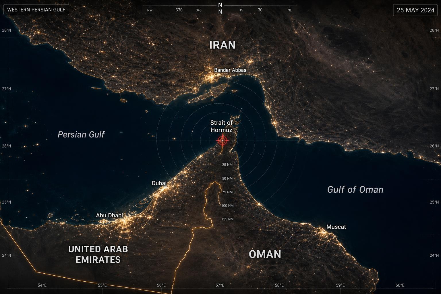
Strait of Hormuz Theater Map
A 21-mile chokepoint that gates roughly one-fifth of global oil and the bulk of Qatari LNG. Iran's coastline dominates the northern shore; mining or harassment here resonates instantly through energy and insurance markets.
Assessment MetadataBUILDING
- Analyst
- Warlord Desk · Strategic Analysis Division
- Published
- Mar 15, 2025
- Updated
- May 14, 2025
- Confidence
- HIGH
- Likelihood
- POSSIBLE
- Time horizon
- 90D
Open-source reporting, official statements, satellite imagery, shipping data, and market signals. No classified inputs.
Methodology →Analytical Chokepoints
- Strait width (narrowest)
- ~33 km
- Daily oil throughput
- ~20% of global supply
- Bypass capacity
- Saudi East–West pipeline only
- Time to reroute
- Not possible at scale
Active Scenarios
Market Spillover
Oil & Energy · Shipping & Insurance
Pressure Points
- ~20% of global oil throughput daily
- Limited bypass via Saudi East-West pipeline
- IRGC small-boat & anti-ship missile reach across full width
- US 5th Fleet forward-based at NSA Bahrain
Why the Geography Matters
The strait narrows to roughly 33km, with shipping lanes hugging Omani waters. Iran owns the high ground and the indentations — every tanker transits within range of shore-based systems. There is no global energy market without this corridor.
Map Legend
- Pressure Points
- View Theater Map
- Escalation Risk
- Key Pressure Point